18 kilometres of generally good quality, including new cycleway, dirt track and quiet lane. Some tracks used by local farmers are passable in dry weather. The route is flat throughout. The main road, quiet at times, need only be used in Rians now that a missing bridge has been installed near Varages.
RIANS – VARAGES
Watch our video…..
As the Conseil Départmental slowly works westward from Flayosc, the stretch from Rians to Varages should be completed in 2024.
Provisional signage has been installed, leading cyclists on and off the route of the old railway line on a fairly conservative basis. But the cycleway is largely useable, and should be officially open by the end of 2024.
Major improvements in 2023 and 2024
However, much of the railway line route is used by local agricultural traffic, and in certain places is distinctly passable for touring cyclists. This means that there are often alternative routes that you can choose from, depending on your personal preferences as well as the weather. In the video below, we took the railway line route from Rians to some 5 kilometres west of Varages, where the line crosses the main road. But at different stages there are alternatives. Here are the stages, step by step.
Rians – Artigues
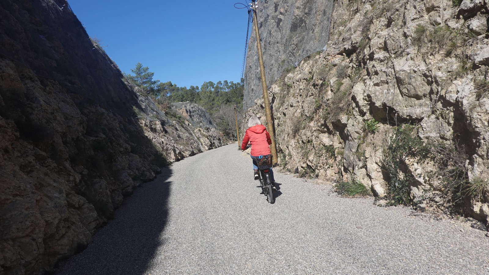
The old Rians station sits on the north west edge of the village. From here, signage leads you on to the D3/D561 by-pass. Then, as you travel east out of Rians, the official signed route takes you along a paved section of old railway line, running south of, and parallel to, the D561. You can spot the signage on your right just after the gravelled waste recycling area where the Avenue du 19 Août 1944 joins the D561. The surface eventually becomes a dirt track, but in dry weather you can continue at least until the Route du Grand Hubac, where you can turn left to rejoin the D561, or continue another kilometre until the old line crosses the main road. This stretch is being upgraded in 2024.
The signed route diverts from this course after 1 kilometre, taking you to the right and up a hill on a small road. This eventually leads back down again farther east until it joins the D561 via the D65 at Artigues. In all this route adds an extra kilometre to your journey, and involves significant hills.
Artigues – St Martin-de-Pallières
From Artigues, the old line runs parallel to the D561 for around a kilometre. Like the previous stretch, this is being upgraded in 2024. It can be muddy in winter but on dry days is very passable. Google maps has a series of street views shot in 2021 on this section, so you can judge for yourself. There are a couple of points where you can decide to continue on road, or join the old railway route. But where it departs from the road and heads north east, it is worth using the track, as you can now ride along it all the way to St. Martin station. Along the way you pass the beautifully restored Esparron station.
Saint-Martin-de-Pallières – Varages : 2023 Update
This stretch of the EV8 was the most problematic when we first filmed the route. But it has been improved in 2023. At the station of St. Martin, the official signed route leads you back to the D561. From here until Varages you were on the main road.
But in 2023, surfacing has been carried out all the way to Varages station. Therefore you can now carry straight on east from St. Martin station for 2.5 kilometres. Here you meet the main D561 road. Now you can cross over to the newly surfaced railway line route, which parallels the main road. Moreover, the missing bridge 2 kilometres farther east has now been installed, so it is now possible to cycle all the way to Varages station off-road. The surface, like most of this section, is not quite finished but is very rideable.
If you wish to go into Varages village itself, turn left at a small crossroads about 500 metres west of Varages station. Follow this surfaced track down and over the Ruisseau de Varages, take the short climb up the other side, and turn right on to the main road. Take the main road up to the village.
Back on the old railway line. 500 metres on from the crossroads, and you will arrive at the old Varages railway station on your left. Another 100 metres and you will reach the tunnel that leads you to the Route de Brue Auriac and the direct cycle route to Barjols and Pontevès.
2023 IMPROVEMENTS
Watch our video…..
PHOTO GALLERY
Rians bypass
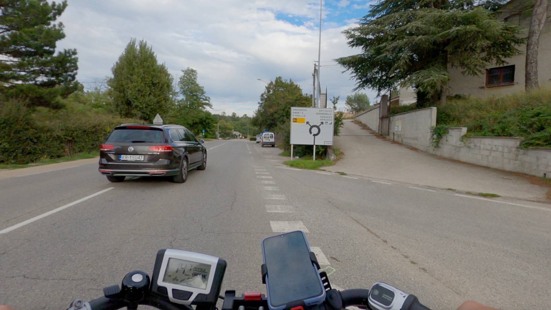
Cycling through the town of Rians is not an option at the moment. Instead, we are taken around the town on a by-pass that can prove busy at times.
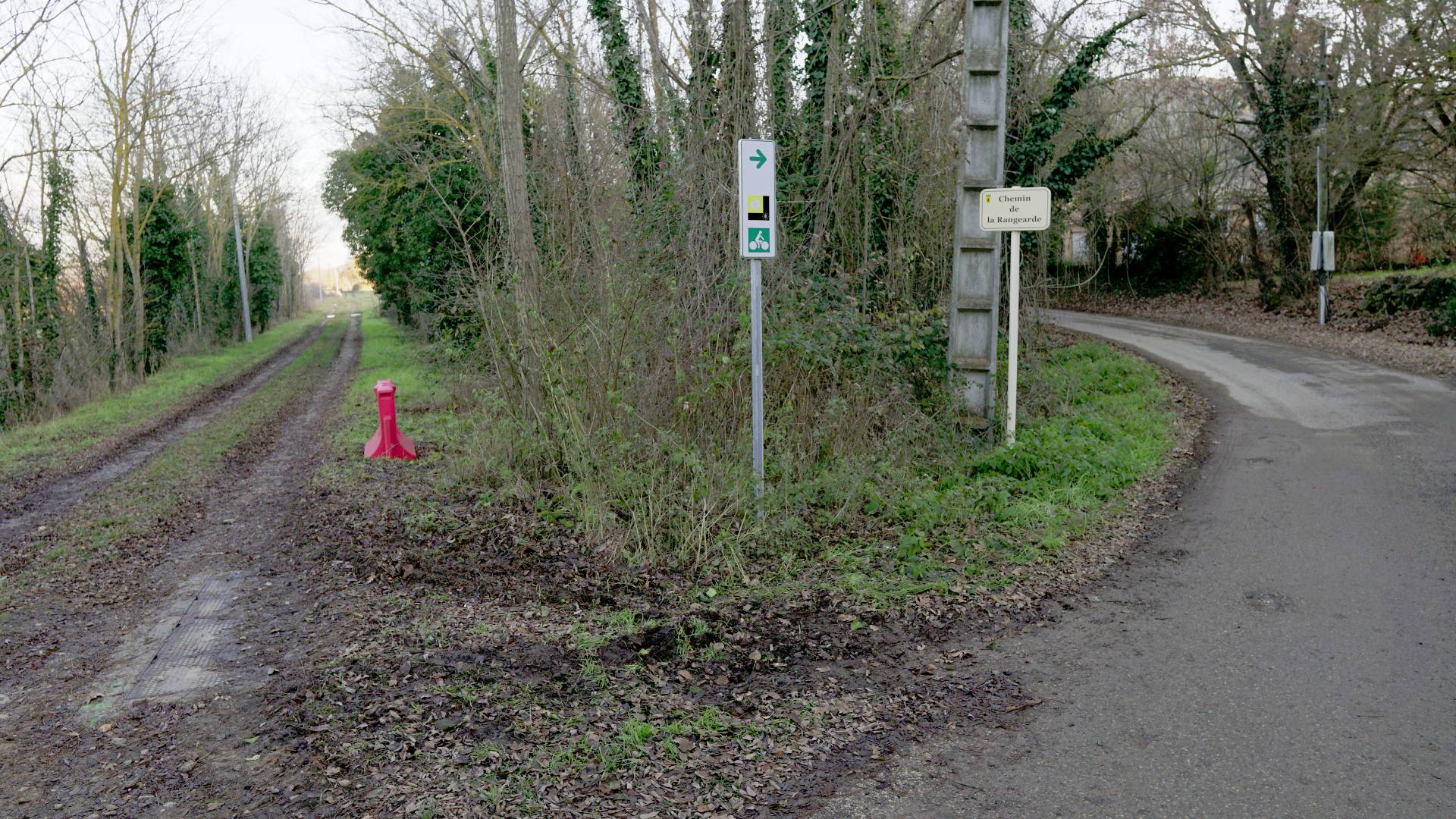
Official route takes to the hills
Two kilometres out of Rians, the official route leads you to the right, up a hillside – and down again. If the weather is dry enough, you can continue on the flat ahead, on the track that follows the railway line route instead. This section should be resurfaced in 2024.
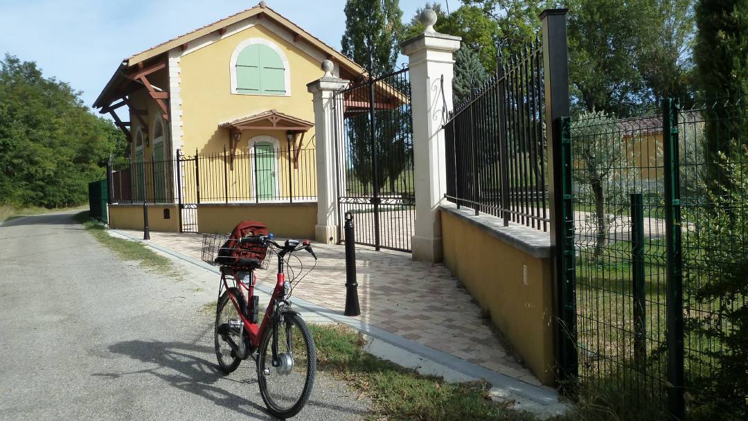
Esparron Station
This beautifully restored series of station buildings is now used as a holiday home. Many of the station buildings along the line remain, though in most instances they have been taken over as depots for the local commune.
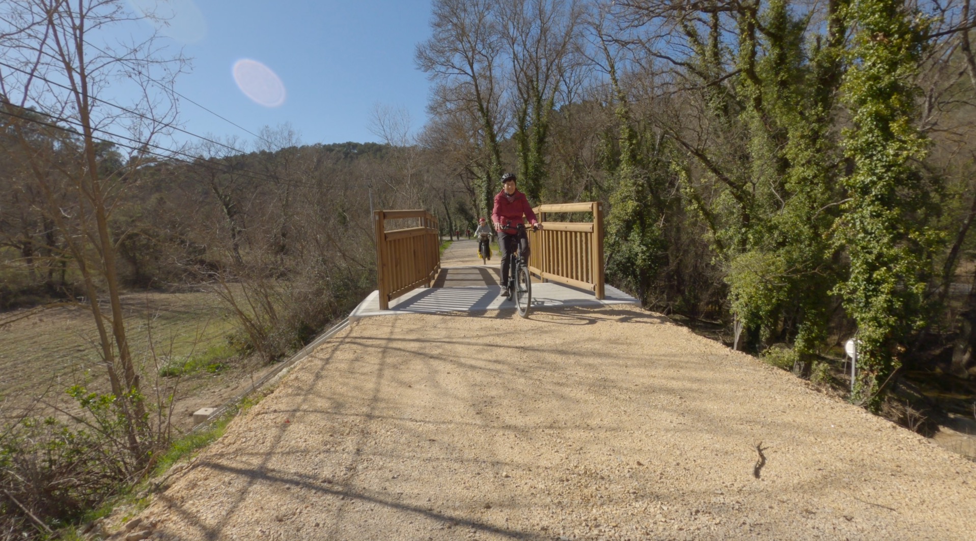
Vital Bridge Built
There are several broken bridges along the EV8 in Provence. They have meant diversions for cyclists on to main roads. This bridge, between St Martin and Varages, was finally built early in 2024. It means cyclists no longer need to use the main road.
New Surfaces
Much of the route has been cleared and resurfaced in 2023 and 2024, and is now a really great cycleway.
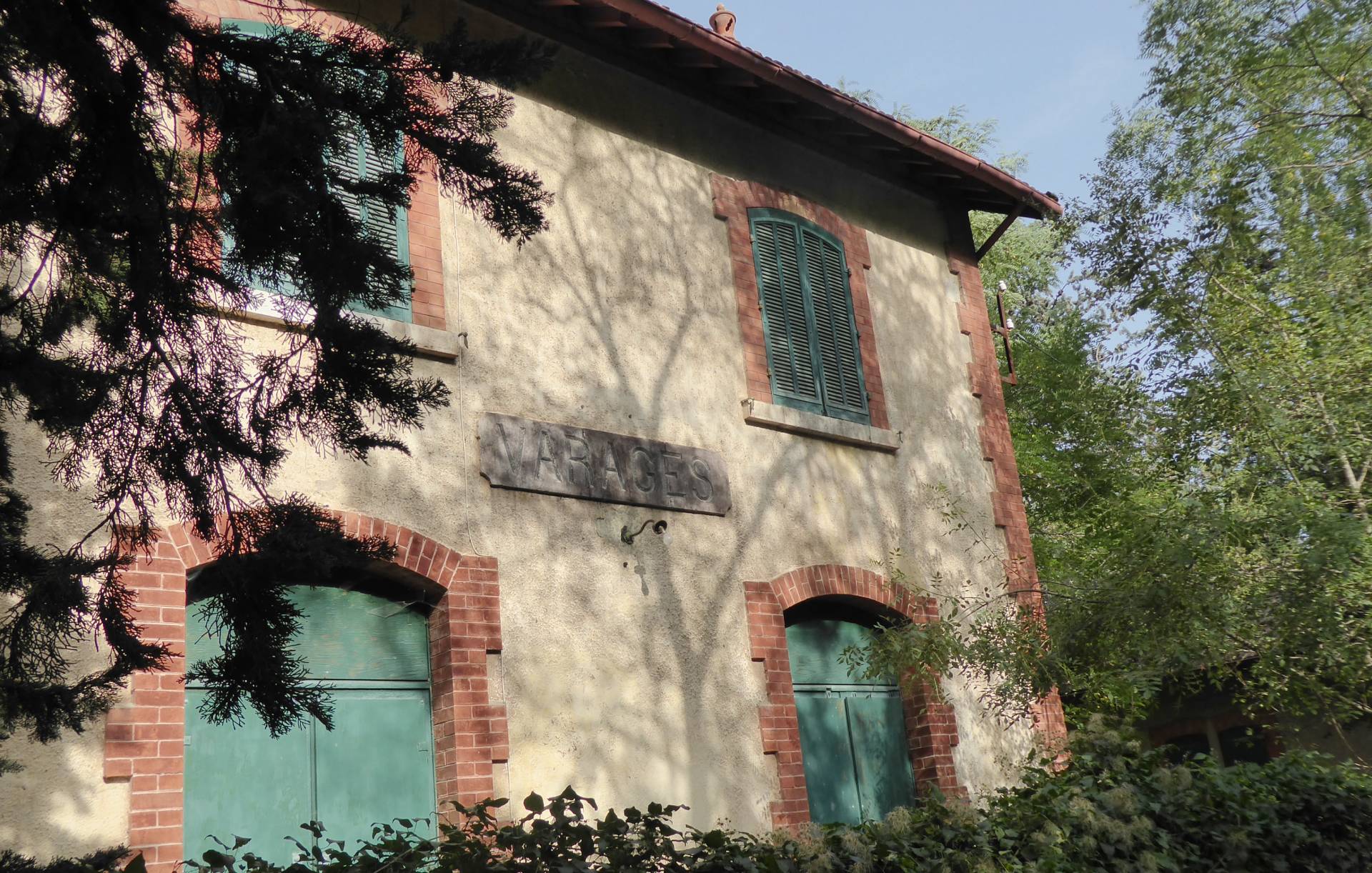
Varages Station
Though not yet cleared, the track alongside the old station is passable. Riding from Rians to Barjols, you can avoid the steep climb into Varages and out again by using this route.
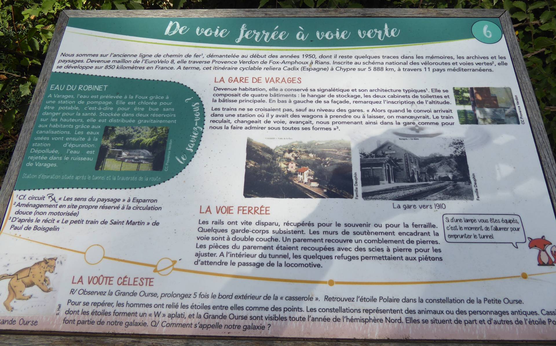
Information along the route
An information panel at Varages station.
INTERACTIVE GPS MAP